
STORM DIANA UPDATE - STRONG & SEVERE WINDS, HEAVY RAINFALL, ORANGE WEATHER WARNING IN PLACE


Latest view of storm Diana in the Atlantic which was named by the Portuguese Met Office yesterday due to a orange wind warning been issued for the Azores Islands.
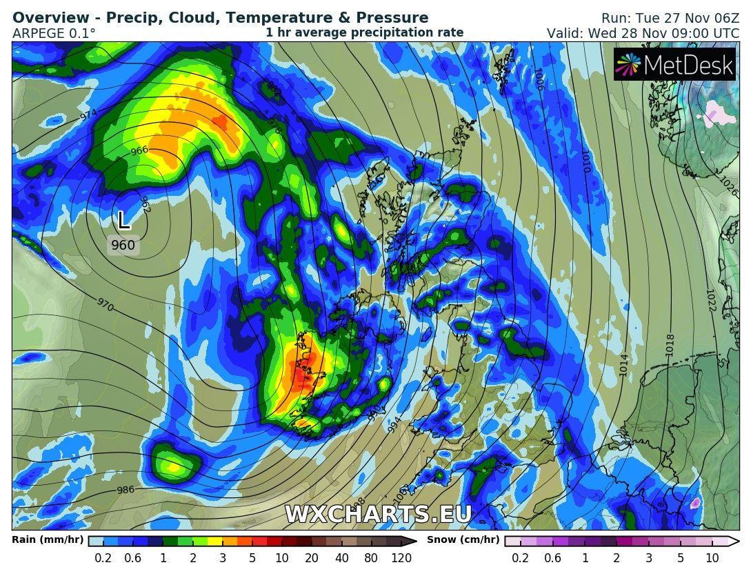
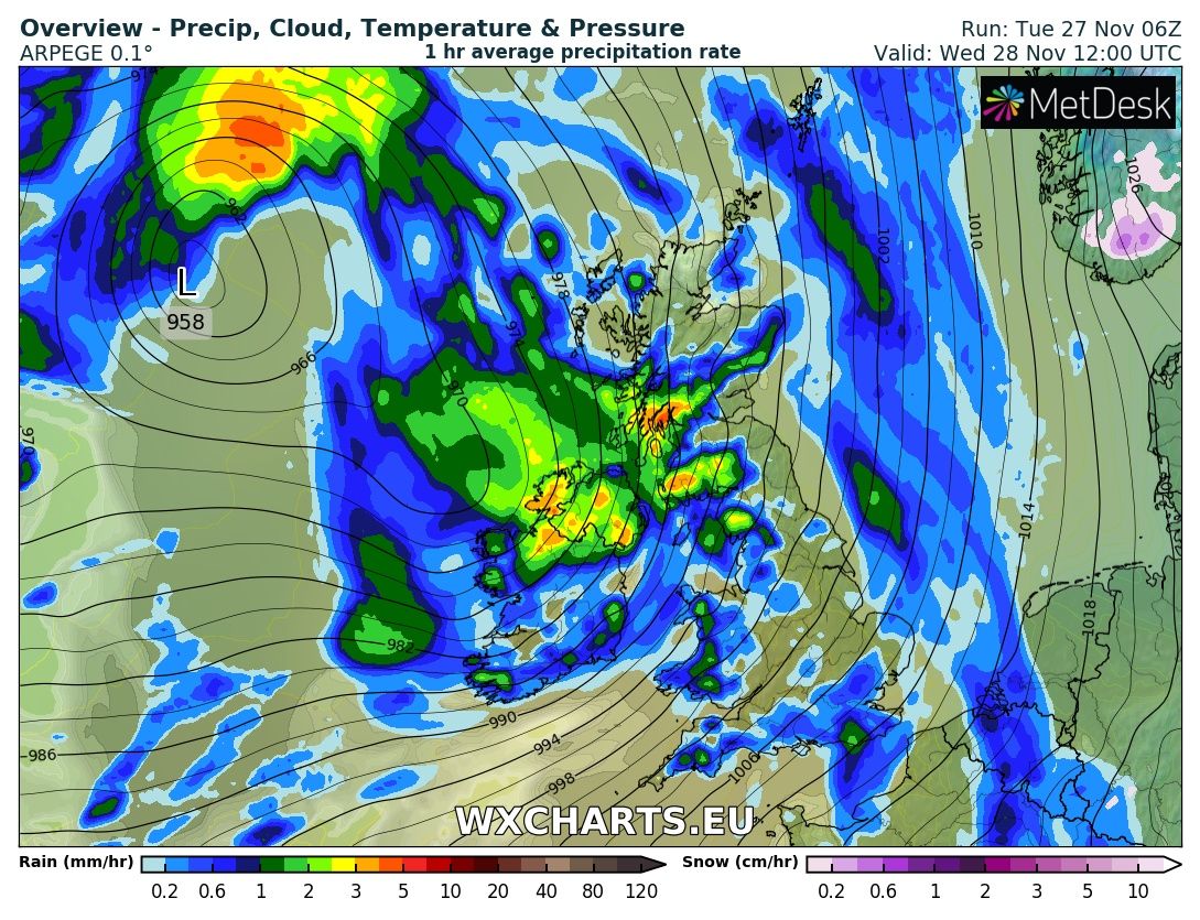
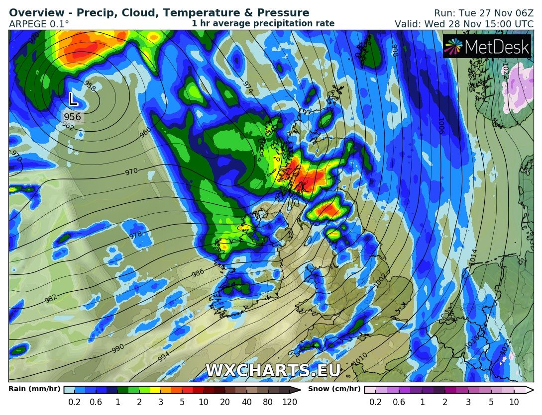
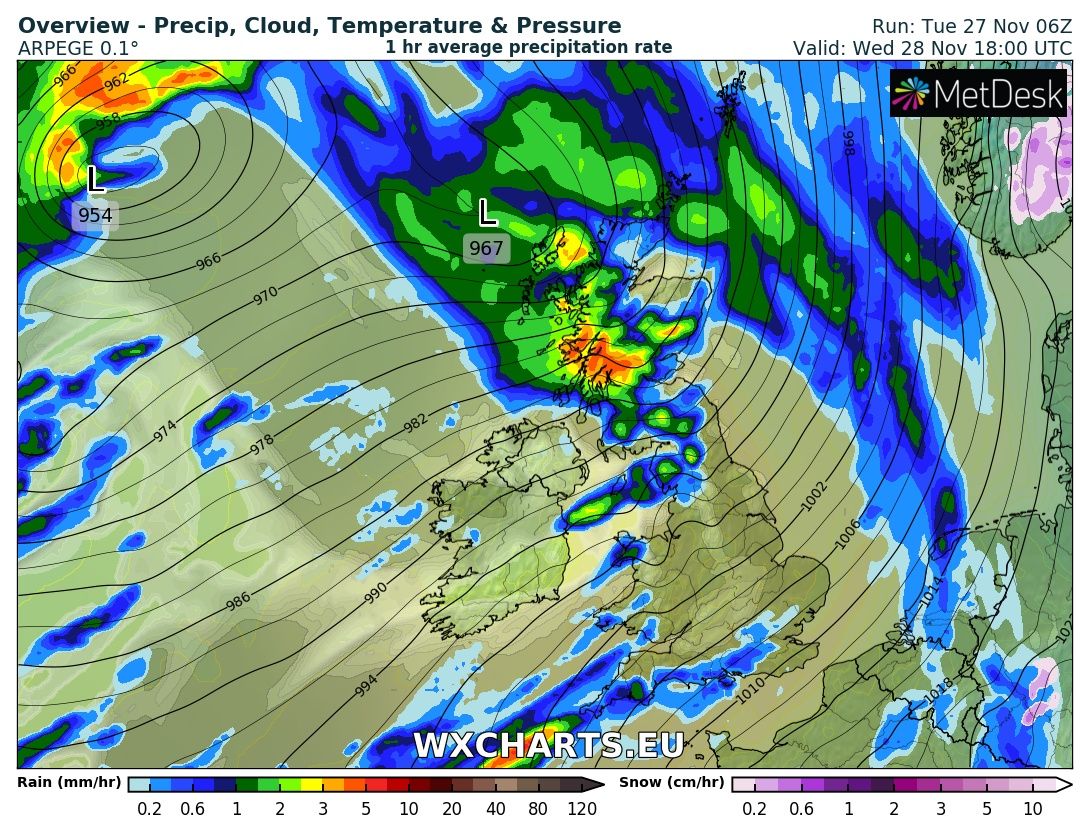
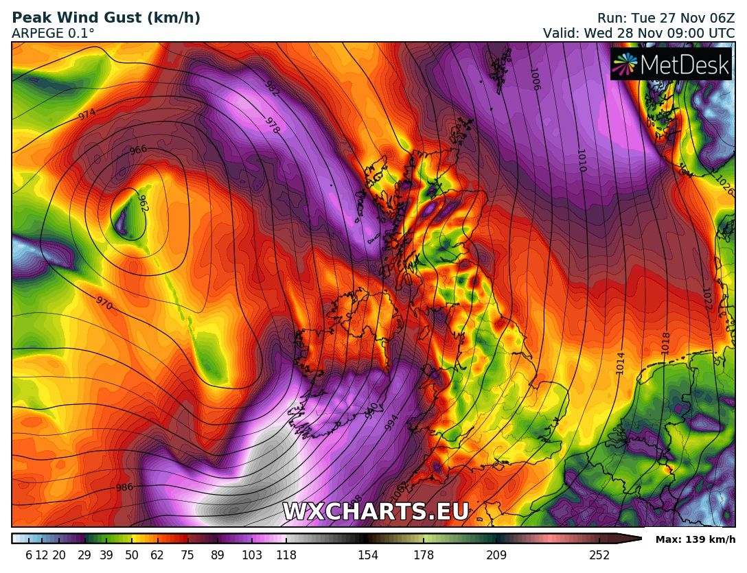
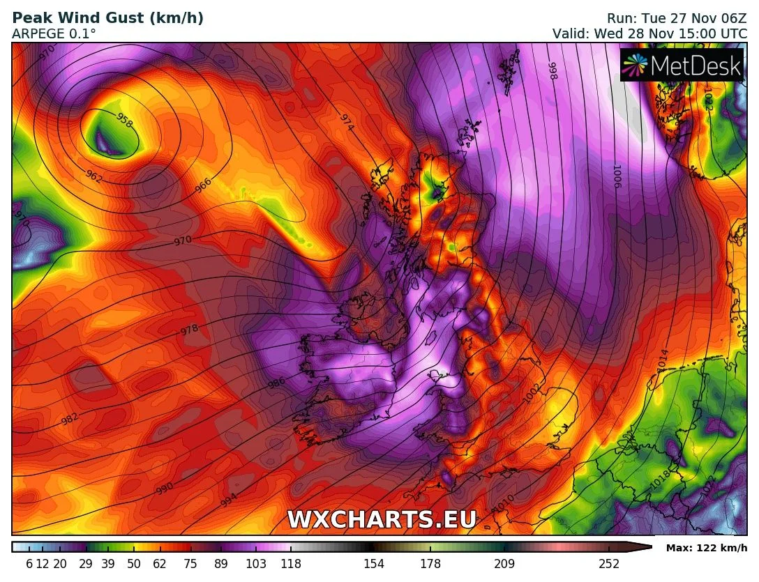
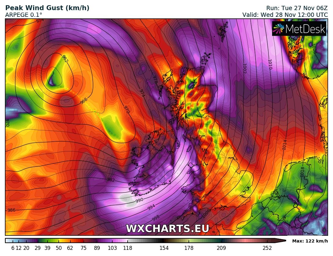
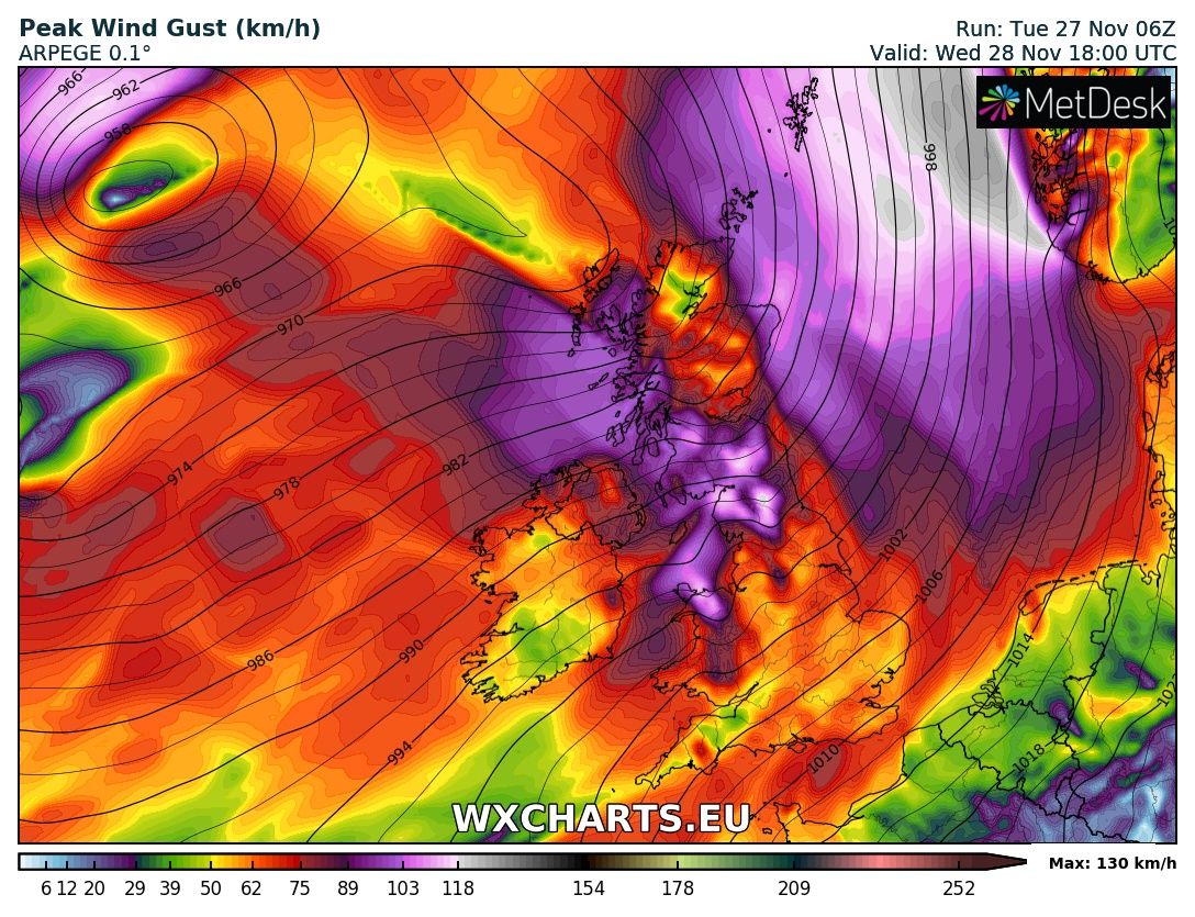
Storm Diana will begin to effect Ireland tonight with heavy rainfall especially across Connacht and west Ulster where there will be the risk of spot flooding. The center of the low will pass close to the west and northwest coast with the strongest winds to the south and southeast of the low.
Strongest winds will be across the west, southwest, south and southeast where severe and damaging gusts of up to 130km/hr will be possible with the risk of trees been uprooted and loss of power especially along coastal areas where there will be the risk of coastal flooding also.
Continues below


Elsewhere there winds will gusts of up to 110km/hr across Ireland with the chance also of small scattered power outages.
The public are advised to travel with caution on Wednesday morning and over the early afternoon hours as Storm Diana passes.
There is the possibility that a sting jet may also form on this storm on the southern flank which can lead to possible stronger gusts but this is never known until it forms.
A sting jet is a meteorological phenomenon that forms as a part of some rapidly developing mid-latitude storms. The 'sting' part of the name refers to the scorpion's tail like shape that the clouds around a sting jet take on. The sting jet contains the most damaging winds, which can reach speeds of more than 100 mph.
The strongest winds on Wednesday will be coming from the (south to southwest)
Kenneth from the Donegal Weather Channel

Make sure to give this article a like on Facebook
2019 CALENDAR NOW ON SALE


2019 Calendar now on sale
You can now purchase the Donegal Weather Channel Calendar 2019. You can purchase the Calendar from the online store
All calendars will be posted out in the middle of November with only a limited amount available. Calendars can be purchased anywhere across the world.


The stunning Leitir Mhic An Bhaird (Lettermacaward) Donegal during May 2018

Vivid Rainbow from up on Breezy mountain South Donegal


I was in Albufeira Portugal I was waiting for the full moon to come up and it did not let me down.
The orange and red tints that the Moon sometimes take on rising and setting are caused by the particles in the Earth's atmosphere. When light (or more specifically, packets of light called photons) from an astronomical object passes through the Earth's atmosphere, it scatters off of particles in the latter.

What a unbelievable night and morning out storm chasing, These number of thunderstorms had to be the best in years as most of the lightning was CG bolts. I even manage to captures Two to three CG bolts in one shot.

One of the most beautiful views of Slieve league From sea and got some nice photos.
Photos from this angle I have not seen yet and it was wonderful to finally capture that moment.
Follow Donegal Weather Channel on other social media platforms by clicking the icons below


